|
11月3~4日(水~木)
Nov 3 to 4.
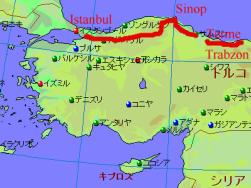
地図は
Fland-Ale 日本世界地図 Ver 3.71を使用。
I used map data "Fland-Ale" and arranged it.
トラブゾンはスメラ修道院で有名な町であったが、天気も良くないので
黒海に突き出す半島があるシノプへ走ることに。途中から雨が振り出し、
サムソン手前の人口約2万人の小さな町、テルメに宿泊。
こんなことならトラブゾンでもう一泊して観光すれば良かったと後悔したが、
「人生万事塞翁が馬」とはよく言ったもの。
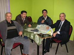
薬局を経営している男性とロカンテ(大衆食堂)で出会い、
彼にお茶とトルコの道路地図を頂くことに。
Sumela monastery is famous seeing spot at Trabzon, but it was not good
weather, I didn't watch this and left Trabzon.
This day was rain day, I stopped riding at the small town "Terme".
I regreted I stayed more one day in Trabzon.
But I met a gentleman in this town restaurant, he paid a cup of tea
and presented a map of Turkey.
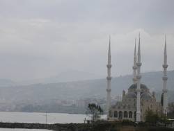 
左:海に面したモスク。この後は雨が続いた・・・
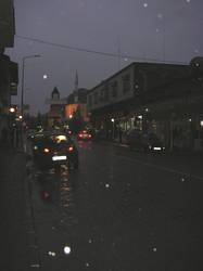
右:宿泊したテルメの町中。午後5時の時点で人通りが殆ど無い小さな町。
Left: Seaside mosque. After it was rain...
Right: Terme center of town. Few persons walked after 5PM.
.
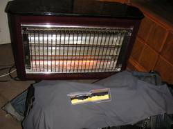 
左:宿の人が貸してくれた電気ストーブ。お陰で濡れた物を乾かせました。
一泊8,000,000トルコリラ(約600円)
右:お世話になった男性に連れられて、サロンにて紅茶を頂く。
Left: Hotel stuff lent an electric stove, I could dry up my clothes.
Right: One gentleman showed a salon.
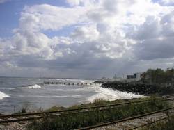
昨日の雨は去り、朝から良い天気が迎えてくれた。波は高いが日差しを浴びた
黒海を右手に見ながら、トルコで最北端の半島がある町、シノプへ移動。
Next day was fine. I went to Shinop most north town in Turkey.
I drove along Blak Sea.
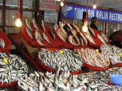  
左:サムスンの街にて。黒海の魚が沢山売られていた。
中:波が高い黒海。
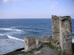
右:シノプはヒッタイト時代から歴史があり、この城壁は紀元前100年頃に築かれた物らしい。
Left: Many fishes were sold at fish shops in Samuson.
Center: Blak Sea ran high.
Right: Sinop was one of the big trading center towns at Black Sea.
There are old wall made in BC100.
|