|
1月16日(日)
Jan 16.
地図は
Fland-Ale 日本世界地図 Ver 3.71を使用。
I used map data "Fland-Ale" and arranged it.
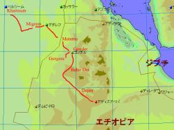
泊まっていたデジェン Dejen の町を出発。直ぐに道はダートの下り坂となり、青ナイルを渡る橋がある
谷底まで降りて行く。自転車の人は大変だろうなぁ、と思いつつ。
橋から今度はダートの道を登り上がると、その後はアジス・アベバまで舗装路が続いていた。
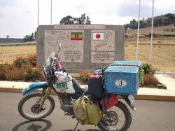
この舗装路、日本の協力で作られたらしく、記念碑が中間地点にあった。
アジス・アベバでは警察官などに道を尋ねながら、何とか情報ノートと駐車場がある Park Hotel に到着。
ホテルにはアフリカに1年以上滞在しているジュンペイ&かおさんが宿泊していて、
さらにUAE→オマーン→イエメン→ジブチ経由でエチオピアへ来た
ちゅうぞうさん もやって来て、お互いのこれまでの旅行、経緯、これからの予定など
ディープな話をしていた。
After I stayed at hotel in Dejen, I moved to Addis Abeba. Dejen is near Blue Nile,
it made deep valley near Dejen. After I acrossed Blue Nile, road chaged paved road.
This road was built by Japanese goverment support. I arrived at Addis Abeba and
stayed in Park Hotel. I met some backpackers, one guy passed through UAE, Oman, Yemen and Djibouti.
Saudi Arabia is difficult country to enter, but if we use this route, we can across Arabian
Peninsula.
左:青ナイルが削った深い渓谷にかかる橋。
右:日本の協力を示すモニュメントの前にて。
Left: The valley and Blue Nile.
Right: The monument of Japanese goverment support.
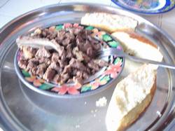 
左:首都に近付くにつれ、この様なエチオピア料理から(この写真は肉の煮込みのチップス)、
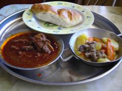
右:イタリア風の料理も食べられる様になってきた。
Left: Gradually move to Addis Abeba, I could eat not only Ethiopian local foods,
Right: but also Italian foods.
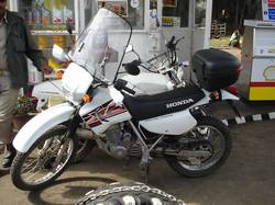 
左:ガソリンスタンドで見た警察の白バイ。HONDA XL200。珍しい。
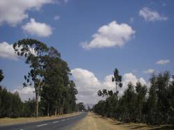
右:アジス・アベバ手前で見た並木。背が高く立派な木々。
Left: "Honda XL200" for police. It was first time for me.
Right: Bonny trees along the road near Addis Abeba.
|