|
2月6日(日)
Feb 6.
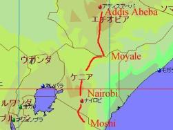
地図は
Fland-Ale 日本世界地図 Ver 3.71を使用。
I used map data "Fland-Ale" and arranged it.
5日間の行程でキリマンジャロ登山に挑戦。初日は2,700 mにあるマンダラハット Mandara hut まで。
熱帯林の山道を4時間かけて登っていく。途中、サルを見たりとこの日は比較的楽であった。
しかし、ハットに到着するものの心拍数がなかなか落ち着かない。
(この時点から既に、高地順応ができていなかったのかもしれない)
We selected 5 days tour and tried to climb up Kilimanjaro.
1st day climbing is until Mandara hut (2,700 m). We spend 4 hours and arrived there.
This mountain trail was in the forest. After reached Mandara hut, my heart rate was keeping
a little high level for a while.
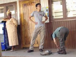 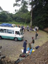
左:出発間際のツアー会社前にて。
右:登山口のあるマラングゲート Marangu gate の駐車場にて。多くの登山客が集まっていた。
Left: A picture front of our ture company office.
Right: At Marangu ate parking. Many tourist started climbing up.
 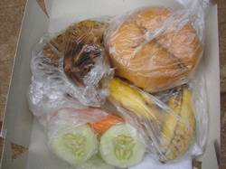
左:本日の昼食。(自分は登山前に食べてしまいましたが・・・)
右:中はパン、フライドチキン、野菜、そしてバナナのセット。
Left: Today's lunch box was
Right: one fried chicken, vegetables, one bread and one banana.
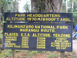 
左:各ハット(山小屋)と標高の表示板。
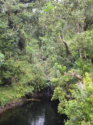
右:登山道の脇には小川が流れていたりも。
Left: An altitude sign bord.
Right: A small river along the mountain trail.
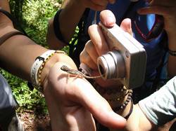 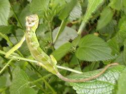
左:途中でカメレオン(トカゲ?)を見付けたり。
右:こちらは緑に変色中。
Left: We found a chameleon.
Right: Ather one is changed its body color.
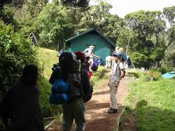 
左:本日の宿泊地に到着。お疲れ様。
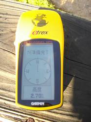
右:GPSにて標高を確認。
Left: We reached Mandara hut. Tired...
Right: Today's final altitude is about 2,700 m.
|