|
2月9、10日(火水)
Feb 9, 10.
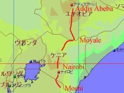
地図は
Fland-Ale 日本世界地図 Ver 3.71を使用。
I used map data "Fland-Ale" and arranged it.
4日目の朝、目が覚めるとりえさんが部屋に戻っていた。
頂上へ残り200 mの高さにあるギルマンズポイント Gilman's point (5,681 m) まで登ったものの、
眩暈を覚えたためそこで断念したとの事。こばさんは見事、最高地点5,895 mにあるウフルピーク Uhuru peak
へ到達。この日は3,700 mのホロンボハット Horonbo hut まで戻り、翌日の最終日には無事に下山となった。
初めて頂上に登れなかった登山となったキリマンジャロ。30年後にでも再チャレンジしたい、
思い出深い山となった。
When I woke up in the morning, Rie returned the room. She could climed up Gilman's point (5,681 m) .
But she got vertigo so gave up climbing top. Koba cluod reach top (Horonbo hut, 5,895 m) .
In this day, we returned to Horonbo hut and could go down next day lunch time.
Mt. Kilimanjaro was my first incomplete mountain to climb top.
But I could gain many experiments and memories. After 30 years, I want to try again.
残念ながら頂上の写真が無いため、こば&りえさん提供の写真をご覧下さい。(以下4枚)
I couldn't reach top, didn't have pictures. Please look Koba & Rie's four photos.
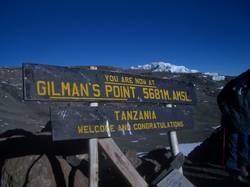 
左:りえさんが到達したギルマンズポイント。
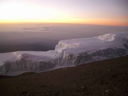
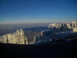
右:朝日を浴びる万年雪。
Left: Gilman's point, Rie reached here.
Right: Shining ice cap.
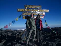 
左:頂上にてこばさんとガイドのジャコブ。
右:温暖化の影響で年々減少している万年雪。30年後にはもう無いのだろう。
Left: Koba & our guide "Jacob" at the top of mountain.
Right: Ice cap was gradually reduced by the global warming.
I think there will be no ice cap after 30 years.
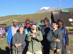 
左:5日目の朝、今回のメンバー全員の写真。
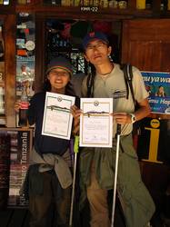
右:登頂証明書を手にするこば&りえさん。お世話になりました。
Left: All stuffs and members in day 5th.
Right: Koba & Rie got the certificate of climbed mountain.
|